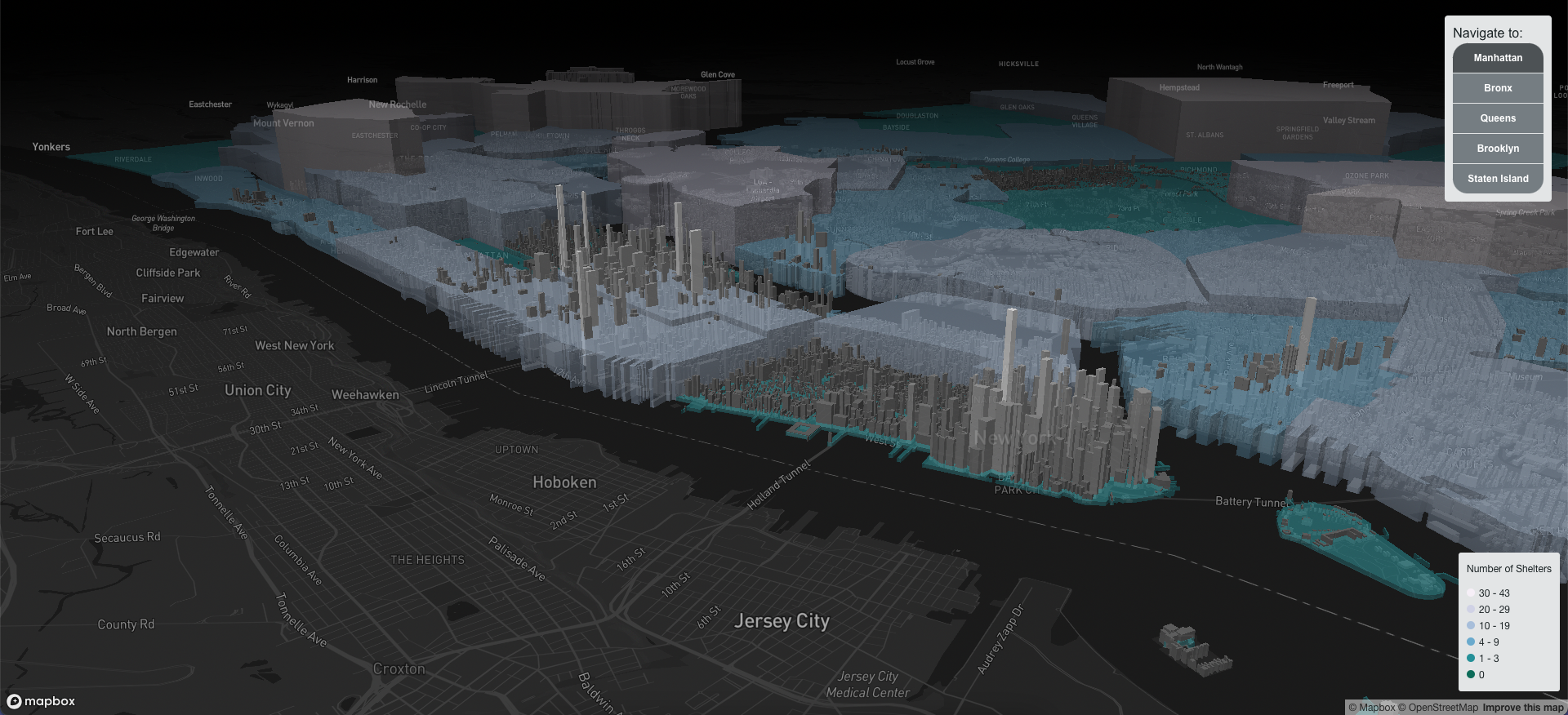
Map of NYC

Shelters in NYC

This map was created with Alex Strada, Public Artist in Residence with the New York City Department of Homeless Services and the Department of Cultural Affairs. The map goal is to depict the relation between the number of shelters and the skyline height in the city as a way to draw attention into their spatial distribution.
December 2024 · Felipe Valdez
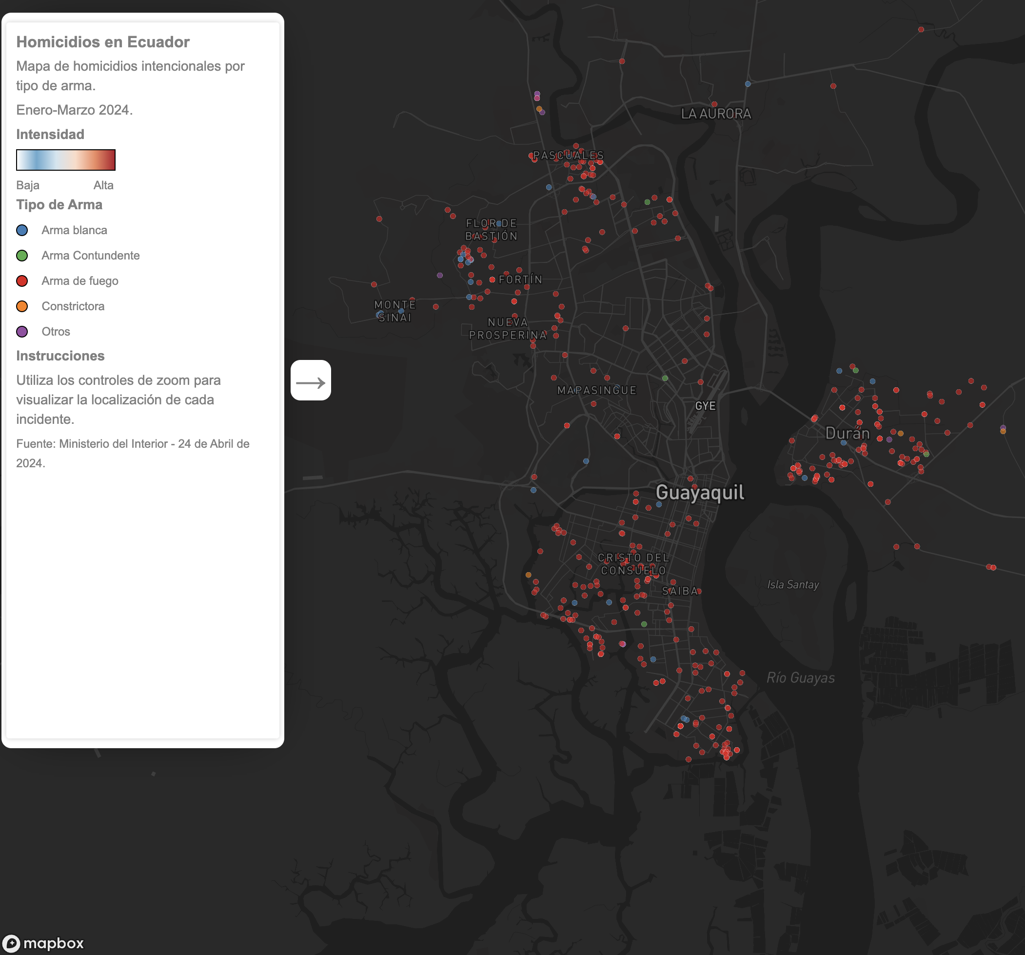
Map of Ecuador

Homicides in Ecuador - Year 2024

This map displays the location of homicides in Ecuador from January to April 2024. When zoomed out, a heatmap displaying the concentration of events is showed. When zoomed in to specific cities each point represents an event. Points are color coded base don the type of weapon used.

April 2024 · Felipe Valdez
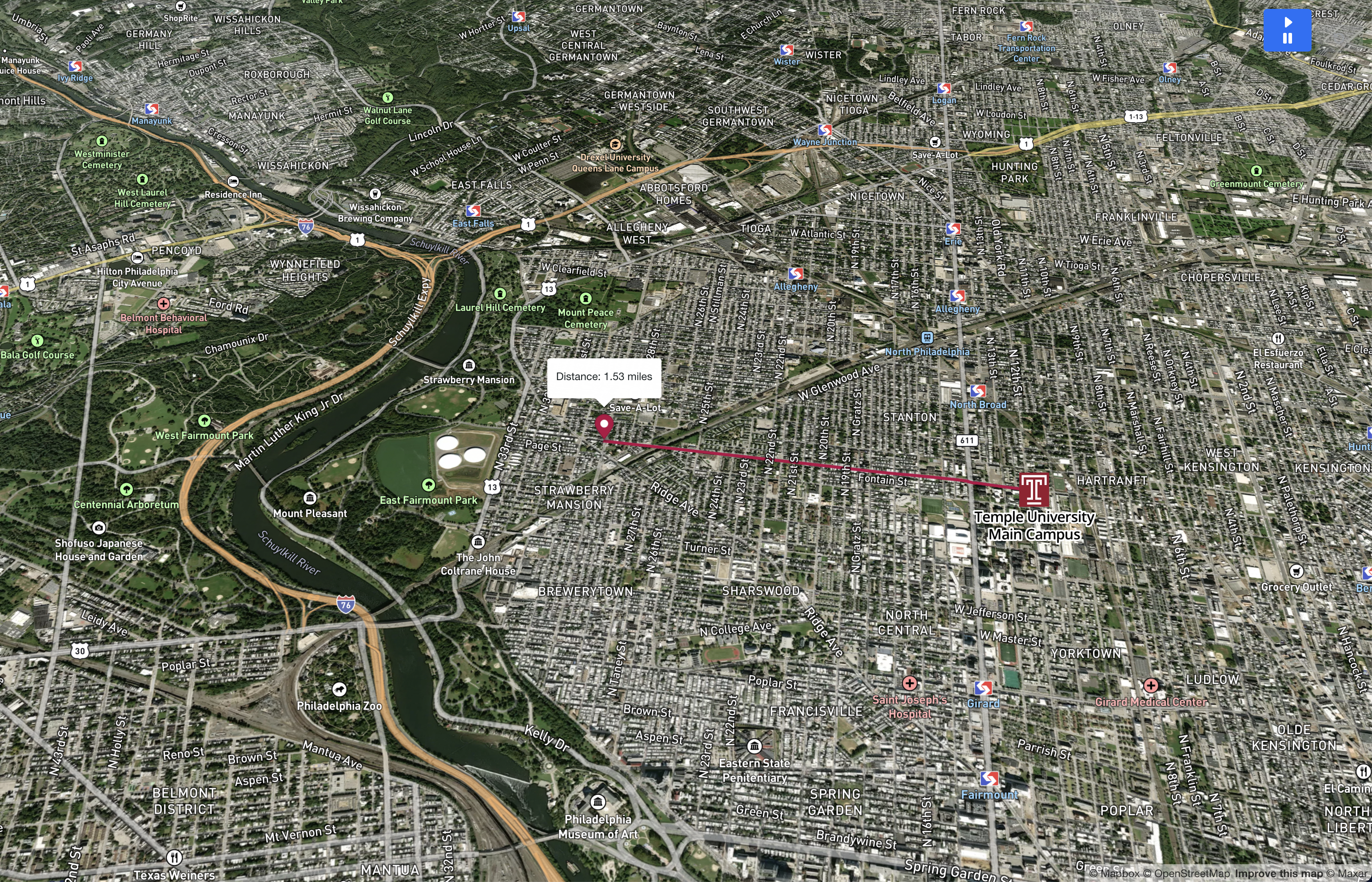
Static image of a map of Philadelphia

Temple University Bike Tour - Animated Map

This map displays an animated route of the tour over a satellite image. The popup window over the marker shows the traveled distance

April 2024 · Felipe Valdez
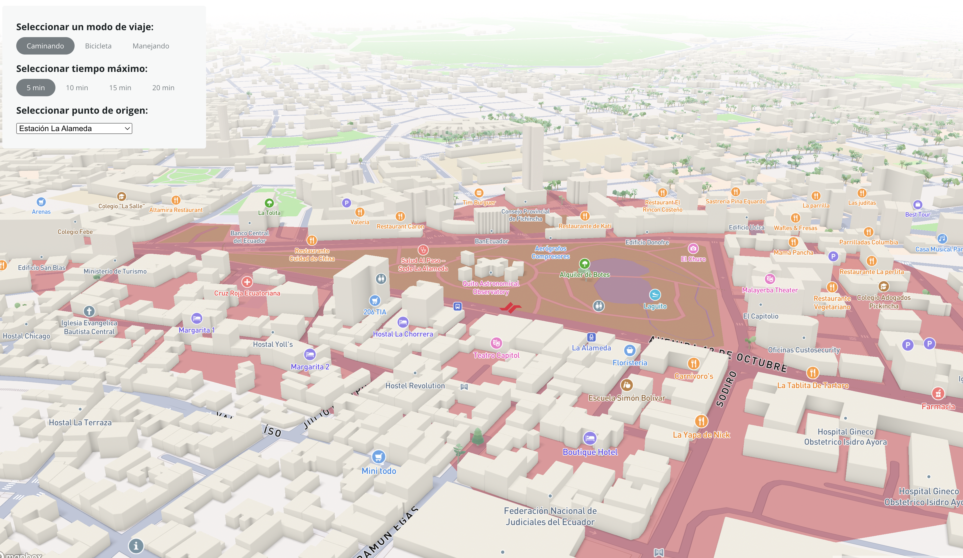
Map of Metro de Quito

Metro de Quito

This map shows service areas from each Metro Station walking, biking and driving for times of 5 minutes, 10 minutes 15 minutes and 20 minutes.

December 2023 · Felipe Valdez
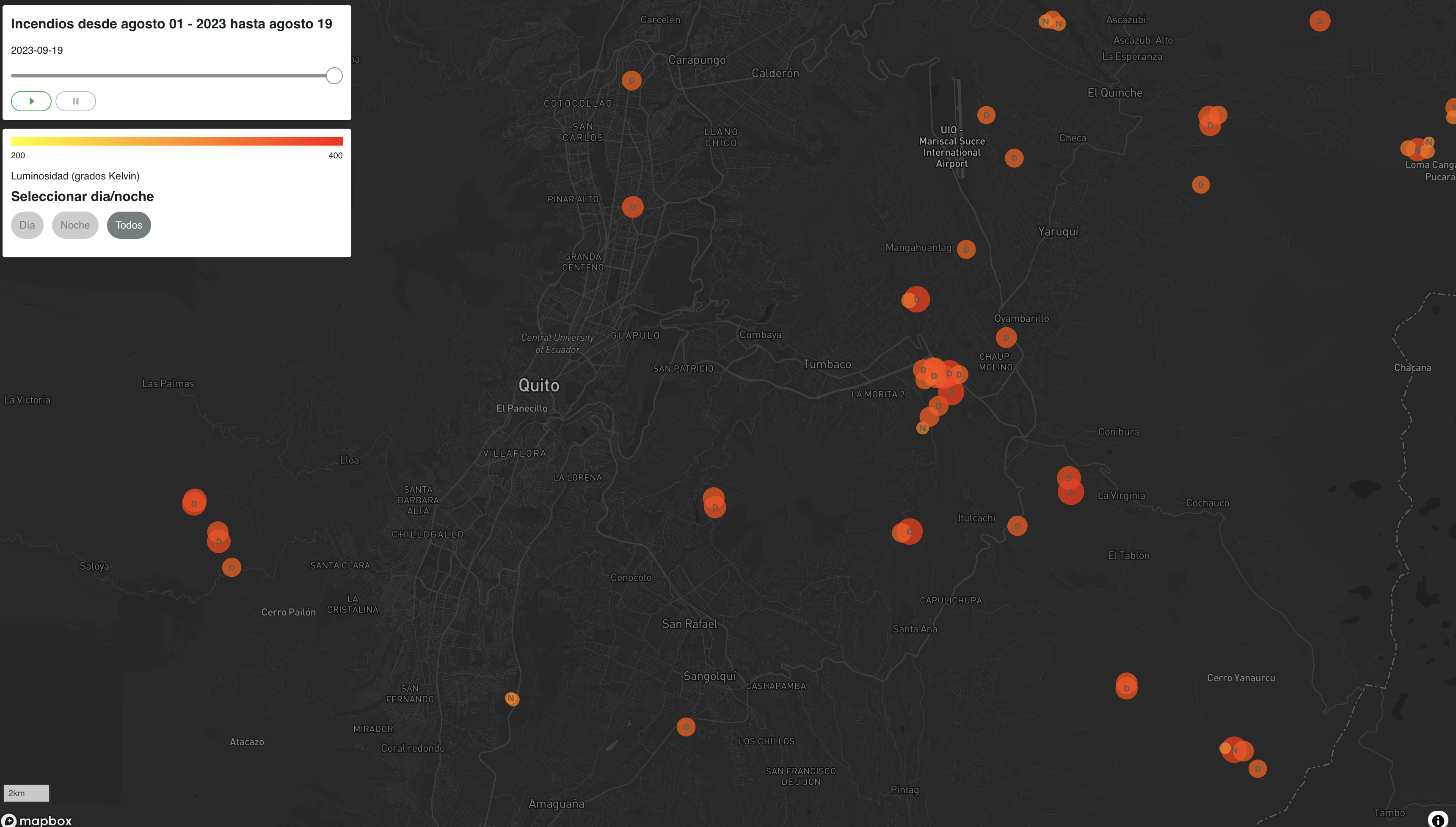
Map of Quito with red spots

Fires in Quito - August 2023

This map shows the location of fires detected using satellite imagery in Quito during August 2023.

October 2023 · Felipe Valdez